- ZABAGED - HOME PAGE
- Introduction
- 1. Settlement, economic and cultural features
-
2. Transport infrastructure
- 2.01 ROAD, MOTORWAY
- 2.02 STREET
- 2.03 CART TRACK
- 2.04 TRAIL
- 2.05 NON-LEVEL CROSSING
- 2.06 UBU LEVEL CROSSING
- 2.07 ROAD NETWORK NODAL POINT (OTHER)
- 2.08 BRIDGE
- 2.09 FOOTBRIDGE
- 2.10 UNDERPASS
- 2.11 LEVEL RAILWAY CROSSING
- 2.12 CULVERT
- 2.13 FERRY
- 2.14 TUNNEL
- 2.15 PARKING, REST AREA
- 2.16 BORDER CROSSING, CONNECTION ACROSS THE BORDER
- 2.17 RAILWAY TRACK
- 2.18 RAILWAY SIDING
- 2.19 RAILWAY YARD
- 2.20 RAILWAY STATION, RAILWAY STOP
- 2.21 METRO STATION
- 2.22 CABLEWAY, SKI LIFT
- 2.23 CABLEWAY PYLON
- 2.24 TRAMWAY
- 2.25 AIRPORT
- 2.26 AIRPORT RUNWAY PERIMETER
- 2.27 AIRPORT RUNWAY AXIS
- 2.28 METRO
- 2.29 SQUARE DEFINITION POINT
- 2.30 FORD
- 2.31 UNREGISTERED ROAD
- 2.32 ROAD IN CONSTRUCTION
- 2.33 AREA OF RAILWAY STATION, STOP
- 2.34 HELIPORT, HELIPAD
- 2.35 RAILWAY TURNTABLE, TRAVERSER
- 2.36 BARRIER
- 2.37 TOURIST HIKING TRAIL
- 3. Distribution networks and pipelines
- 4. Waters
- 5. Territorial units, including protected areas
- 6. Vegetation and grounds
- 7. Terrain relief
- 8. Survey control points
- OVERVIEW OF CHANGES
| Feature category: | 2. Transport infrastructure |
| Feature type: (with ordinal number) |
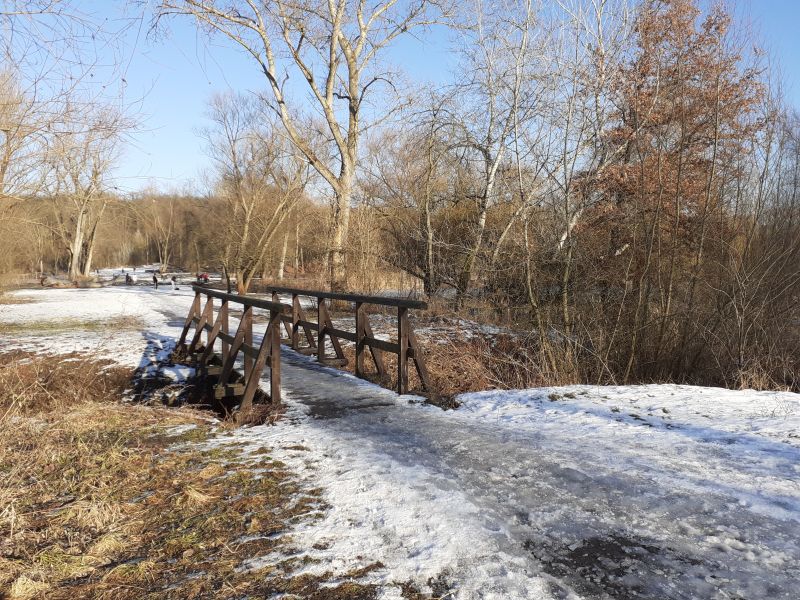
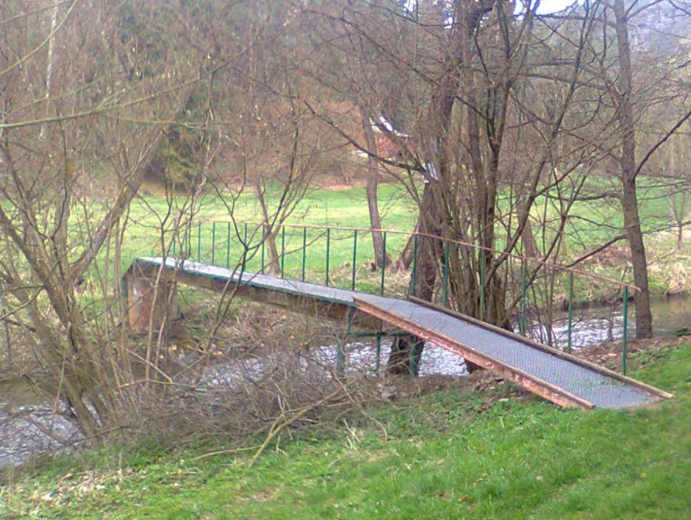
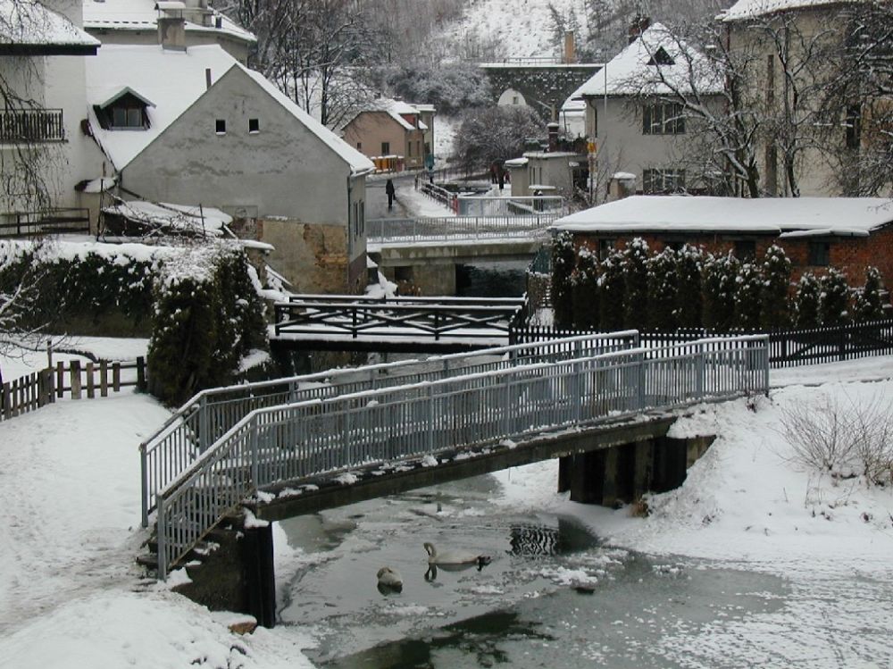
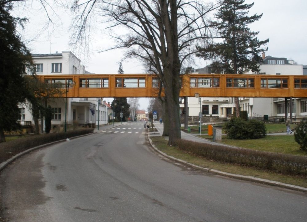
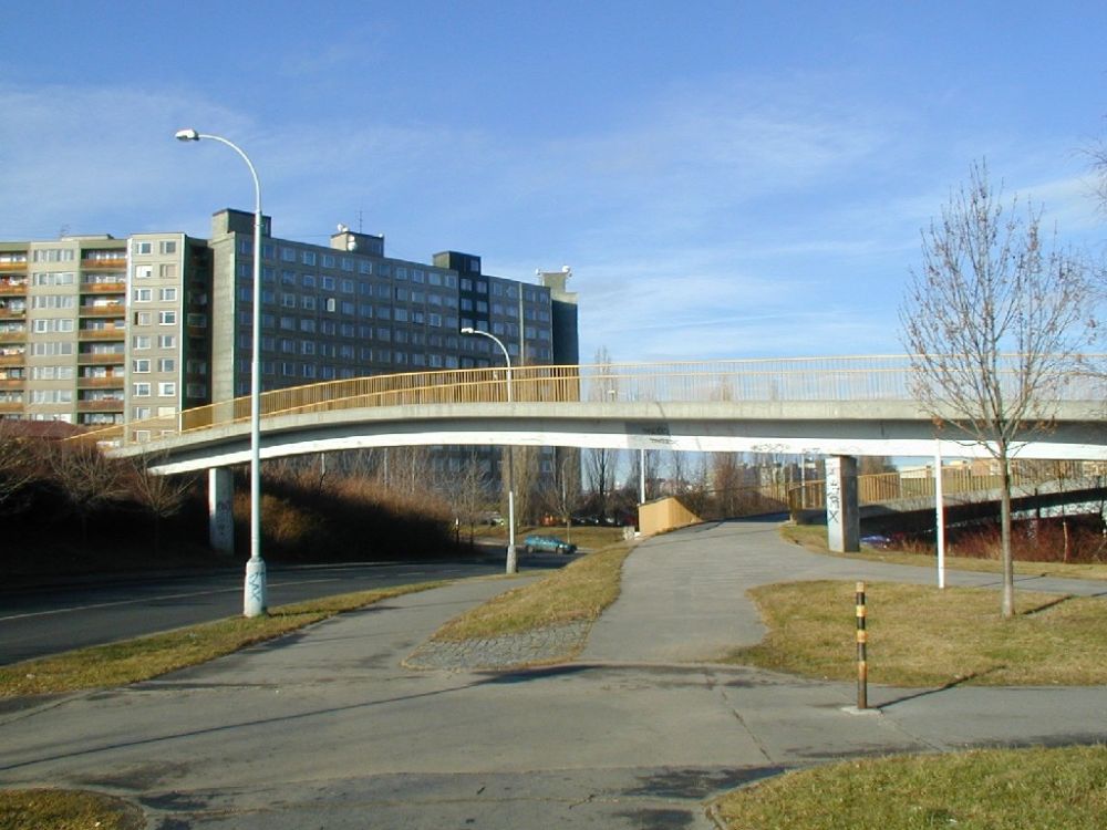
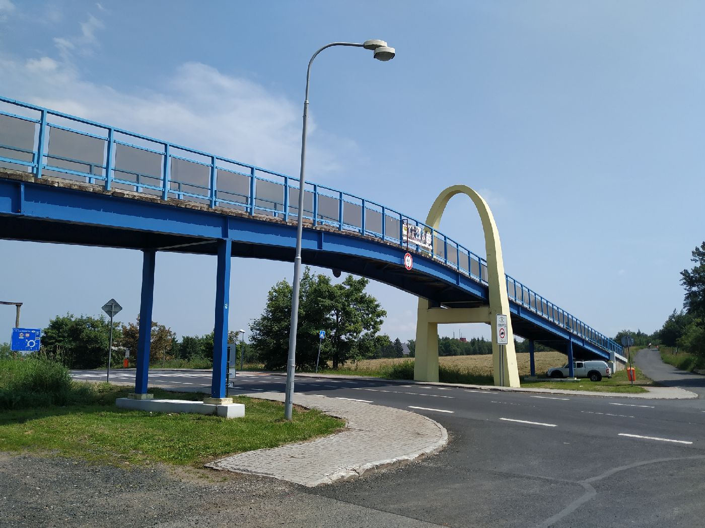
2.09 FOOTBRIDGE (LÁVKA) |
| Feature type code: | aq043, AQ043P |
|
Feature definition: A separate bridge feature serving pedestrians when overcoming water, or other natural obstacles, as well as when overcoming railway, road or street, as well as product pipelines, pipelines and other artificial obstacles. |
| Geometric determination of the feature: | line or point |
| Positional accuracy: | mp = 2,0 m |
| Geometric data source: | aerial survey photos, orthophoto, field recognition |
| Descriptive data source: | Geonames |
| A t t r i b u t e s : |
| Attribute name | Data type | Attribute subject | Attribute values | Code list |
| JMENO | VARCHAR2(100) | name transferred from Geonames | ||
| FID_ZBG | VARCHAR2(40) | unique feature identifier in ZABAGED® |
| S i z e r e s t r i c t i o n s : |
length < 10 m, graphic representation is a point
length ≥ 10 m, graphic representation is a line, when crossing with a two-line watercourse there is always a line
|
| E x a m p l e s : |
|
| F e a t u r e h i s t o r y : |
|
2016-04-01: JMENO - attribute data type changed (VARCHAR2(80) -> VARCHAR2(100)) |
Extended web version updated to: 01.07.2026
Contact: Content Guarantor: Petr Neckář (e-mail: Petr.Neckar@cuzk.gov.cz; tel: +420 284 041 667)
Content Filling: Marek.Popp@cuzk.gov.cz | Technical Solution: Antonin.Baco@cuzk.gov.cz, Petr.Cerveny@cuzk.gov.cz
Contact: Content Guarantor: Petr Neckář (e-mail: Petr.Neckar@cuzk.gov.cz; tel: +420 284 041 667)
Content Filling: Marek.Popp@cuzk.gov.cz | Technical Solution: Antonin.Baco@cuzk.gov.cz, Petr.Cerveny@cuzk.gov.cz