| Feature category: |
4. Waters |
Feature type:
(with ordinal number) |
4.11 BANK LINE (BŘEHOVÁ ČÁRA) |
| Feature type code: |
bh000 |
Feature definition:
Line delimiting the water surface.
|
| Geometric determination of the feature: |
line - perimeter line of water flow or water surface |
| Positional accuracy: |
mp = 2,0 m |
| Geometric data source: |
aerial survey photos, orthophoto, LLS, field recognition |
| Descriptive data source: |
- |
| Attribute name |
Data type |
Attribute subject |
Attribute values |
Code list |
| FID_ZBG |
VARCHAR2(40) |
unique feature identifier in ZABAGED® |
|
|
| S i z e r e s t r i c t i o n s : |
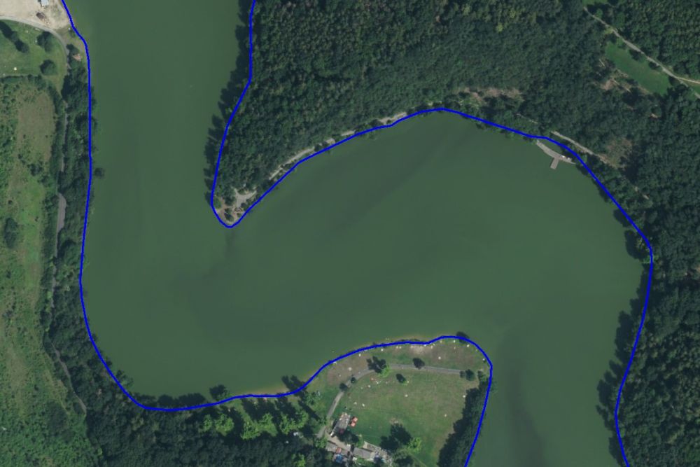 Feature visualization in ZABAGED® operational environment - bank line is represented by blue line
|
| F e a t u r e h i s t o r y : |
Extended web version updated to: 01.07.2026
Contact: Content Guarantor: Petr Neckář (e-mail: Petr.Neckar@cuzk.gov.cz; tel: +420 284 041 667)
Content Filling: Marek.Popp@cuzk.gov.cz |
Technical Solution: Antonin.Baco@cuzk.gov.cz, Petr.Cerveny@cuzk.gov.cz